New Guidance for Municipalities in Conducting Climate Vulnerability Assessments Download HERE
The Climate Change-Related Hazard Vulnerability Assessment (CCRHVA) Guide is now available online for municipal leaders and planners to bring their municipalities in compliance with the New Jersey Municipal Land Use Law (MLUL) and prepare their communities for climate change.
The guide is aimed at assisting New Jersey’s elected and appointed officials and community leaders with efforts to assess and address impacts of climate change throughout all systems that sustain their communities.
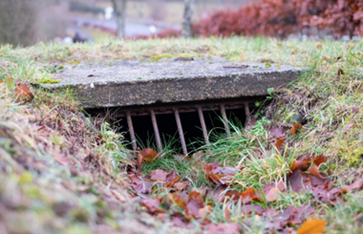
New Jersey Stormwater Retrofit BMP Guide
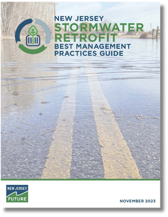
Stormwater Best Management Practices (BMPs), including detention basins, infiltration basins, bioswales, and rain gardens, are implemented to manage stormwater and improve water quality. Often seen in New Jersey, these BMPs were designed and implemented before the MS4 permitting program was created in 2004 and before the NJ Stormwater Management Rules required green infrastructure
To fill these gaps and to assist MS4 permittees in complying with the updated permit, New Jersey Future and Princeton Hydro created the New Jersey Stormwater Retrofit Best Management Practices Guide. This guide provides municipalities, counties, nonprofit organizations, developers, and property owners the tools to identify opportunities to retrofit existing stormwater BMPs and install new stormwater BMPs in New Jersey’s highly built-out environment.
Check out the Retrofit BMP Guide HERE
Inland Flood Protection Rules
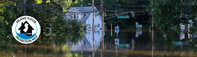
NJ has now adopted a landmark Inland Flood Protection Rule to better protect New Jersey’s communities from worsening riverine flooding and stormwater runoff. A courtesy copy of the rule and additional information are available here.
The Inland Flood Protection Rule updates New Jersey’s existing flood hazard and stormwater regulations by replacing outdated precipitation estimates with modern data that account for observed and projected increases in rainfall. These changes will help reduce flooding from stormwater runoff and increase the resiliency of new developments located in flood-prone inland areas. New Jersey is the first state to use predictive precipitation modeling to implement rules to inform and protect future development and redevelopment from the impacts of climate change.
The Inland Flood Protection Rule establishes design elevations that are reflective of New Jersey’s changing climate and more frequent and intense rainfall, replacing standards based on outdated data and past conditions. The updated standards will apply to certain new and substantially reconstructed developments in inland riverine areas that are subject to flooding, but they do not prohibit development in these flood hazard areas. Under the two primary components of the rule:
In connection with the proposed Inland Flood Protection Rule, to aid the public to gauge flood risk and provide a visual approximation of regulatory jurisdiction on specific parcels, the DEP has launched a flood indicator tool. While the tool does not provide a definitive demonstration of regulatory jurisdiction or calculate actual risk, it can be useful in assisting property owners or prospective property owners on potential risk and, by referencing the 500-year flood extent, approximate DEP’s regulatory jurisdiction and flood risk. Equipped with this information, property owners may then decide to take additional steps to determine actual risk, which is dependent on site-specific conditions.
The Inland Flood Protection Rule updates New Jersey’s existing flood hazard and stormwater regulations by replacing outdated precipitation estimates with modern data that account for observed and projected increases in rainfall. These changes will help reduce flooding from stormwater runoff and increase the resiliency of new developments located in flood-prone inland areas. New Jersey is the first state to use predictive precipitation modeling to implement rules to inform and protect future development and redevelopment from the impacts of climate change.
The Inland Flood Protection Rule establishes design elevations that are reflective of New Jersey’s changing climate and more frequent and intense rainfall, replacing standards based on outdated data and past conditions. The updated standards will apply to certain new and substantially reconstructed developments in inland riverine areas that are subject to flooding, but they do not prohibit development in these flood hazard areas. Under the two primary components of the rule:
- The elevation of habitable first floors will be two feet higher than currently indicated on DEP state flood maps and three feet higher than indicated on FEMA maps.
- Applicants for certain permits will use DEP’s New Jersey-specific precipitation data when calculating peak flow rates of streams and rivers for permits under the Flood Hazard Area Control Act Rules, N.J.A.C. 7:13, as well as when proposed development triggers compliance with DEP’s Stormwater Management rules, N.J.A.C. 7:8.
In connection with the proposed Inland Flood Protection Rule, to aid the public to gauge flood risk and provide a visual approximation of regulatory jurisdiction on specific parcels, the DEP has launched a flood indicator tool. While the tool does not provide a definitive demonstration of regulatory jurisdiction or calculate actual risk, it can be useful in assisting property owners or prospective property owners on potential risk and, by referencing the 500-year flood extent, approximate DEP’s regulatory jurisdiction and flood risk. Equipped with this information, property owners may then decide to take additional steps to determine actual risk, which is dependent on site-specific conditions.
The Power of Trees

Around 80% of the U.S. population lives in urban areas—and faces particular climate risks. Cities are dominated by pavement, buildings, and dense infrastructure that hold heat and are prone to flooding from stormwater runoff. These built environments can amplify the risks associated with extreme heat and heavy rainfall events made more likely in our warming climate.
Alongside buildings and pavement, U.S. urban areas also contain an estimated 5.5 billion trees that provide important benefits to people. A growing body of research shows that urban trees and greenspaces support healthy, equitable, and resilient cities. At the same time, urban forests are themselves vulnerable to urbanization and climate change; they require adequate stewardship to continue benefiting communities.
SEE The Power of Urban Trees for Full Report
Energy Efficiency: Free Audits and Financial Incentives for New Construction
New Jersey’s Clean Energy Program (NJCEP) offers incentives to municipalities and local businesses for choosing energy efficient equipment on new construction and substantial renovation projects. Municipalities also have the opportunity to get started with a free energy audit through the Local Government Energy Audit Program (LGEA).
Congratulations to the 51 municipalities that received their free audit in the past 6 years!
NJCEP aims to produce the most efficient buildings in the nation. For additional information, visit NJCleanEnergy.com or call 866-NJSMART.
FINAL MS4 PERMITS ISSUED
New Jersey’s Department of Environmental Protection (NJDEP) has issued its Final Municipal Separate Storm Sewer System (MS4) New Jersey Pollutant Discharge Elimination System (NJPDES) Master General Permit. The Final Master Permit Effective as of 1/1/2023 can be found Here. All previously designated Tier B municipalities must now comply with the new Tier A permit. The Schedule for Compliance with all New Permit Rules can be Found Here
This new permit will bring about several changes in the standards for towns, including:
- Creation of Watershed Improvement Plans
- TMDLs (Total Maximum Daily Loads – pollution budgets created to reduce the amount of pollution entering a waterway)
- Evaluation of overburdened community impact and prioritization of projects in these communities
- Passage of ordinances to address issues like, salt storage and tree protection
- Creation of a municipal stormwater webpage
NJ To Issue Guidance on Siting Warehouses for Municipalities - See Guidance Document HERE

The guidance aims to:
These guidance documents go into how municipalities can achieve these aims across eleven related areas of focus. Local governing bodies and planners can utilize some or all of these areas, as they choose, to address the challenges they face.
- Facilitate a proactive, rather than a reactive, approach;
- Provide municipal factors to consider when developing or updating a Master Plan and reviewing applications and requirements;
- Encourage a regional approach to planning, siting, and facilitating the logistics facilities.
These guidance documents go into how municipalities can achieve these aims across eleven related areas of focus. Local governing bodies and planners can utilize some or all of these areas, as they choose, to address the challenges they face.
Resilient NJ - A Guide for Municipalities to Integrate Climate Vulnerability Assessment Into Their Land Use Planning - See the Guide Here

Decisions by local and regional governments about zoning, redevelopment, housing, open space, and capital investment will have dramatic implications for the vulnerability of the natural and built environments.
Integrating climate change into these decisions and all planning efforts will put your community on the track to resilience by making sure investments made today withstand the conditions of tomorrow and make it easier to adapt as the climate continues to change.
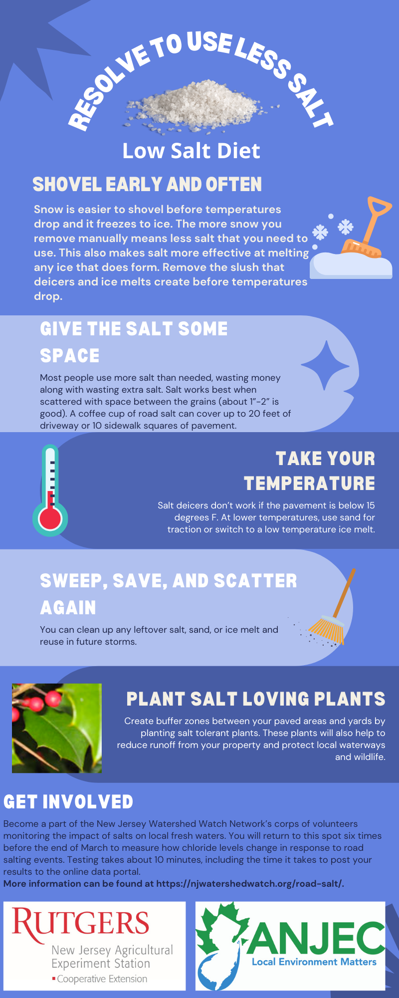
Resolve to Use Less Salt in the New Year

Roads in New Jersey will become slipperier as winter brings colder temperatures and snowstorms. Road salts and deicers are used to clear ice-covered streets, improve traffic conditions, and reduce accidents. While making our roads safer to drive on, road salts also have been shown to affect water quality by raising the salinity (‘saltiness’) of freshwater rivers, streams, and groundwater (Kaushal et al. 2018). Large rivers, such as the Passaic River (Ophori et al. 2019), and even coastal waters like the Barnegat Bay (Goodrow et al. 2017) are seeing increased salinity.
Increasing amounts of salts in the environment can have many effects on our day-to-day lives. Human health can be impacted as drinking water supplies become unusable. Pets and wildlife can have their paws burnt by excess deicers on sidewalks and driveways or become sick from ingesting salts. Roadside vegetation and landscape plants can experience leaf burn. Many commercially important shellfish, like oysters and clams, can only spawn and grow in a lower range of salinity and may become scarce due to increased salinity. Soils may become too salty for certain native plants to grow, allowing invasive vegetation to take over natural areas.
References:
Goodrow, SM et al. 2017. ‘Long-Term Temporal Water-Quality Trends within the Barnegat Bay Watershed, New Jersey’. Journal of Coastal Research.
https://meridian.allenpress.com/jcr/article/doi/10.2112/SI78-003.1/204316/Long-Term-Temporal-Water-Quality-Trends-within-the
Kaushal, SS et al. 2018. ‘Freshwater salinization syndrome on a continental scale’. Proceedings of the National Academy of Sciences.
https://www.pnas.org/content/115/4/E574
Ophori, D. 2019. ‘Impact of road deicing salts on the Upper Passaic River Basin, New Jersey: a geochemical analysis of the major ions in groundwater’. Environmental Earth Sciences.
https://faculty.uml.edu/nelson_eby/89.315/Professional%20Papers/Ophori2019_Article_ImpactOfRoadDeicingSaltsOnTheU.pdf